St. Augustine Cemetery — Aerial View & Map Overlay
(Click image below to launch new window with Google Map)
|
|
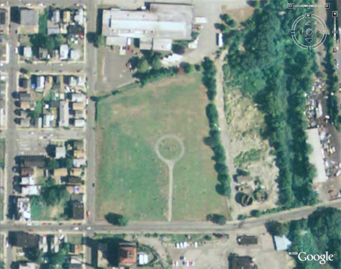
Close up view of St. Augustine Cemetery as seen from above (Courtesy of Google Earth)
Central monument of William St. Ledger is situated in the center of the cemetery circle.
(Google Earth Coordinates: Latitude 41° 11'22.91" N / Longitude 73° 10'24.15" W)
|
|
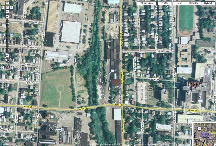
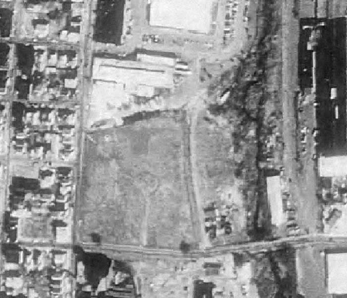
1991 Aerial View of St. Augustine Cemetery (Arctic St. visible along bottom, Helen St. runs north/south at left)
|
|
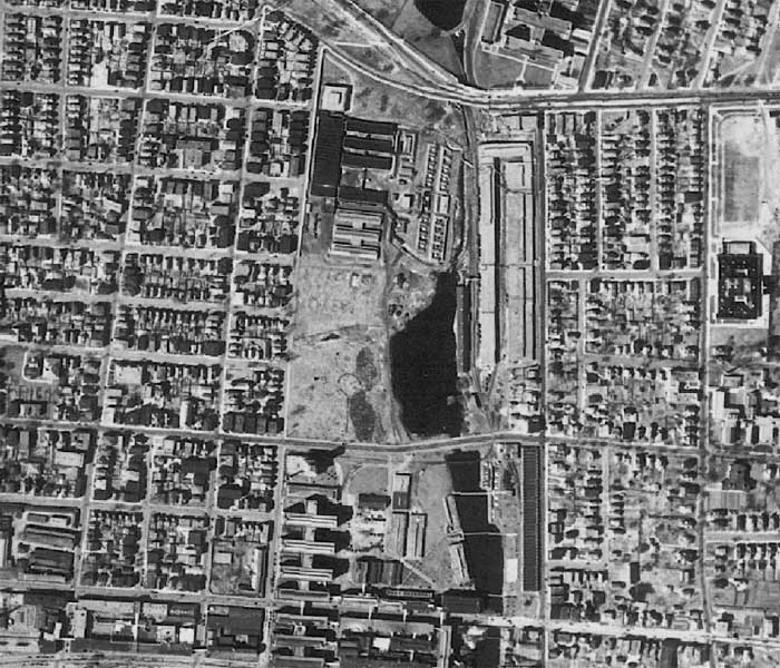
1934 Aerial View of East Bridgeport & St. Augustine Cemetery (in center of image)
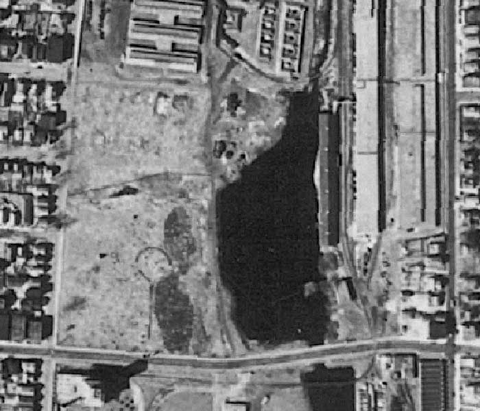
View below is a close up of St. Augustine Cemetery as it appeared in 1934 (Pembroke Lake still visible along right border)
|
|
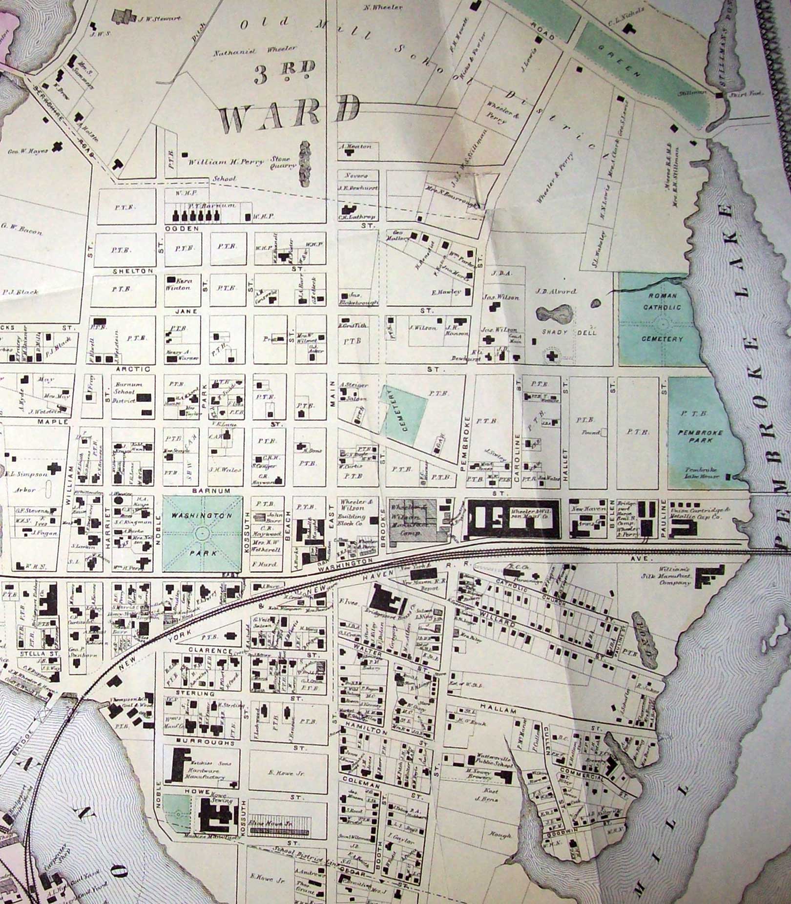
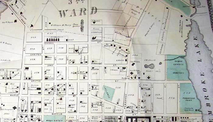
1867 partial map of East Bridgeport, 3rd Ward, showing site of St. Augustine at right, labeled 'Roman Catholic Cemetery'
Note another cemetery visible just south of Arctic Street, between East Main Street and Pembroke Street
(Click image below to view larger version in a separate window)
|
|
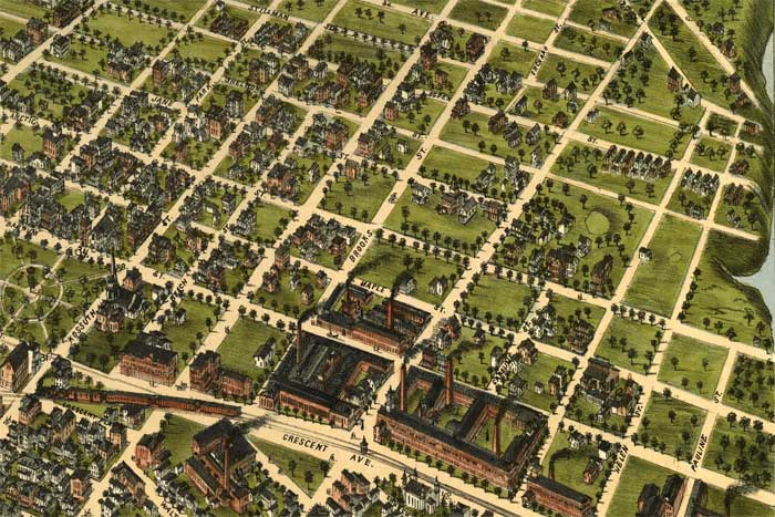
1875 partial birds eye view of East Bridgeport (Pembroke Lake at far right)
Cemetery was in use, but is not shown at corner of Helen & Arctic Streets.
|
|
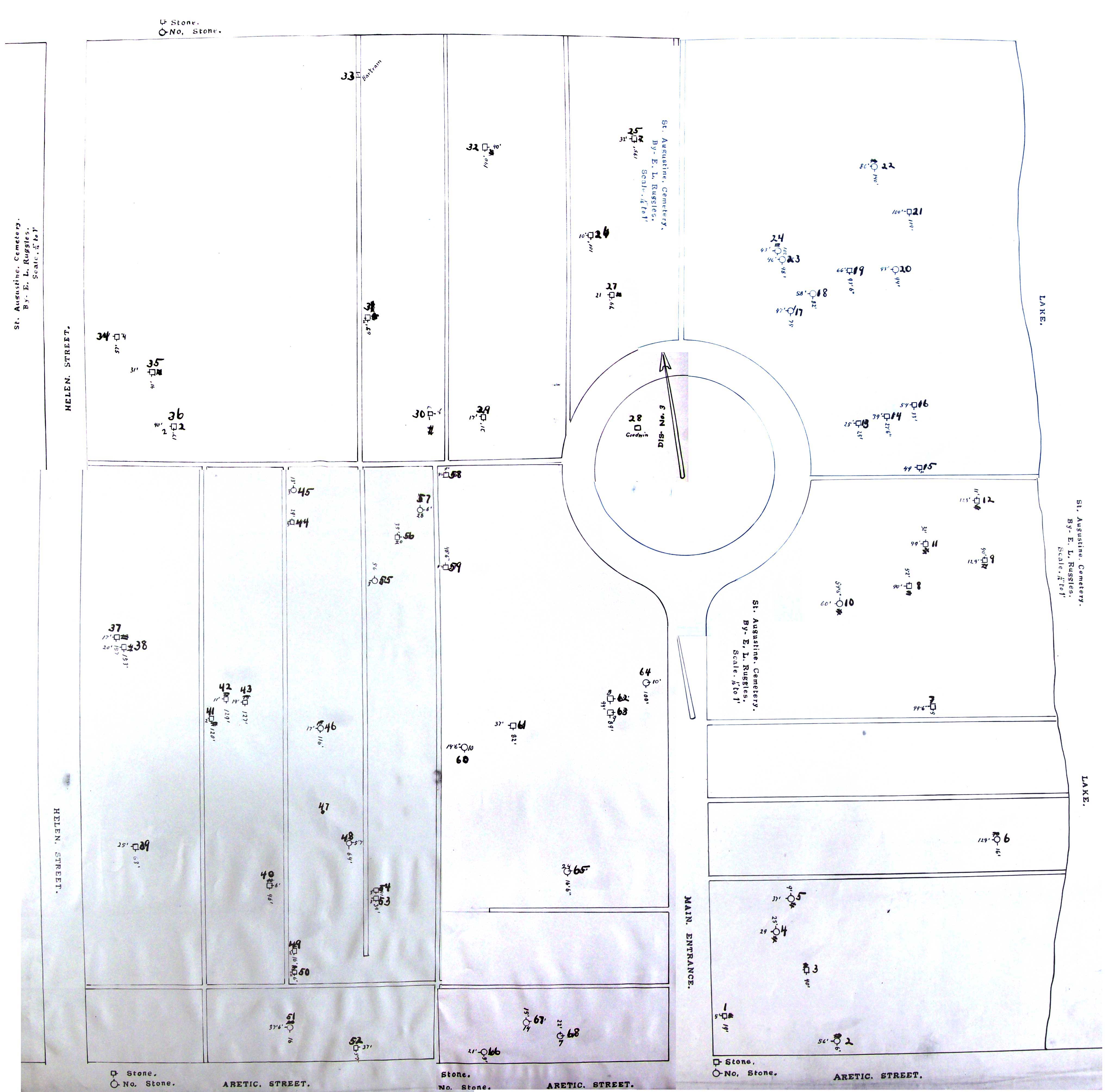
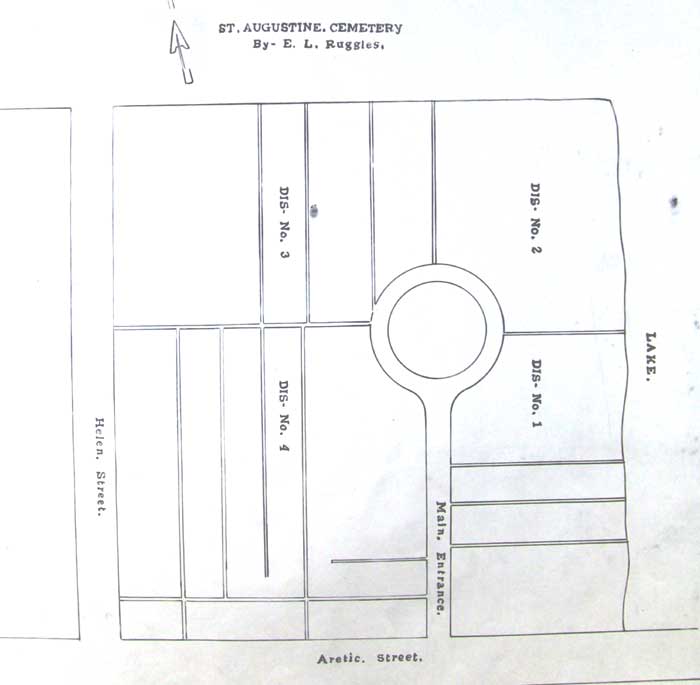
Map of St. Augustine Cemetery (Bridgeport CT), used to document location of Civil War Veterans
(Click on image below to view enlarged version with detail for individual grave markers)
|
|
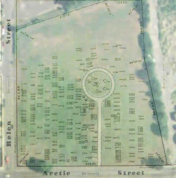
Aerial view of St. Augustine Cemetery with overlay of 1956 survey map showing 328 stone markers
|
|